Hot days in Vanturarita
Day 1 – Pahomie Hermitage – Curmătura (Saddle) Oale –Vioreanu Peak–Vânturariţa Peak–Ştevioara Saddle–Pahomie Hermitage
Date: 25.07.2015
Team: 4 persons
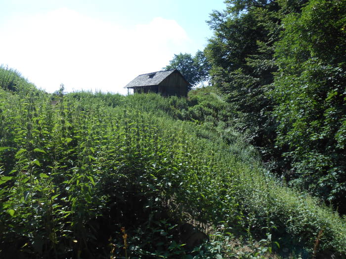
We left Cheia village in the morning, going to Pahomie Hermitage. The road from Cheia to Pahomie is in good condition and we arrived here without events. We parked the car at the hermitage and went back on the forest road for 100 m when we left it for a lateral forest road to the left.
As the road went hard up in its first part, we focused on the climb (the temperature was already hard to bear) and forgot to look for the marked path that should have appeared somewhere on the left, few minutes from entrance on the lateral road. So, after about 30 minutes, we reached the end of the forest road without seeing any marked path.
We were lucky to find the trail marked with yellow point, somewhere higher, without having to go down all the way climbed up to this point.
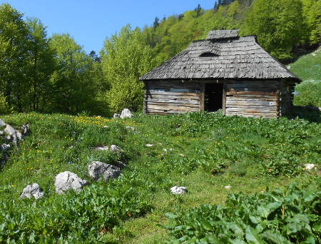
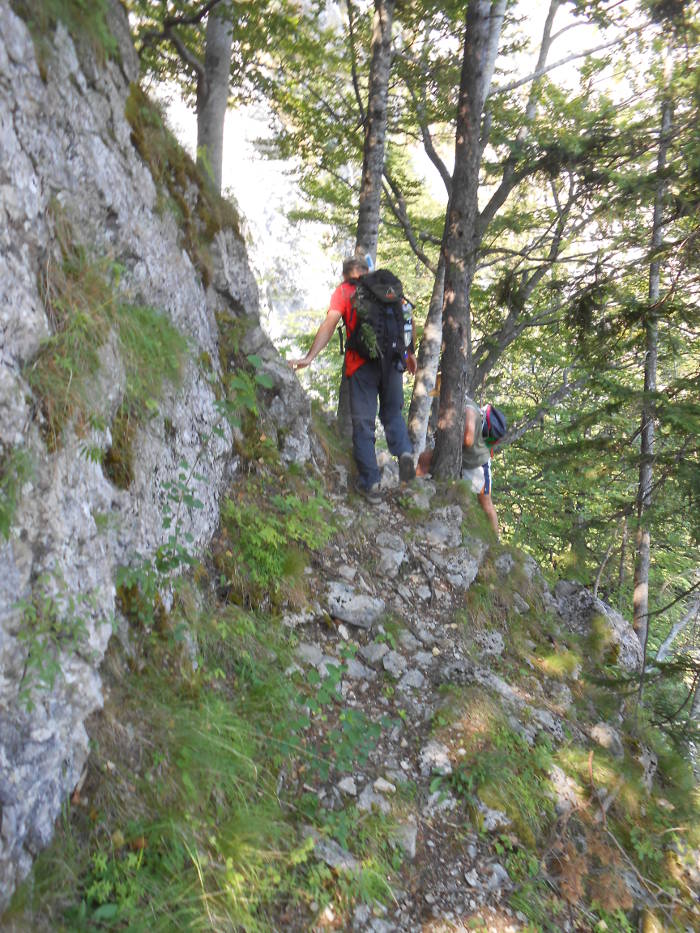
Finally on the right way, we uphill hard through the forest and in about an hour we reach a sheepfold.
Sheepfold in Vanturarita Mountains
From somewhere a dog gave an alarm, and others answered it different places on the mountain, so after a short break, we hurried to leave the area, following higher and higher, the yellow marking.
In a short time, we go out into a blooming little valley, bordered by the forest climb it, on the right or left side after the marking sign.
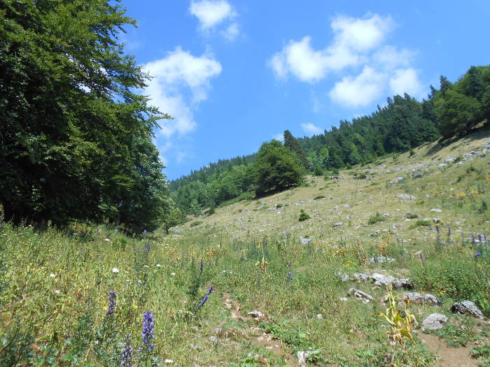
The way to Curmatura Oale
The appearance of the rocks announced us the proximity of the ridge. After about 2.5 hours of leaving Pahomie we reached Curmatura Oale (Oale Saddle).
Landmarks in Curmatura Oale
This is somewhat atypical,being a kind of glade on a wooded ridge. We made a well-deserved 10 minutes stop in a shady place and then continued to Vanturarita on a road which, as indicated the marking pillar, would last 3.5 hours.
Marking – red strip (new).
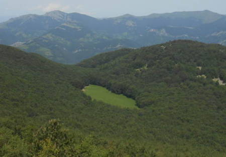
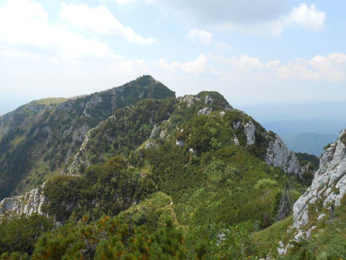
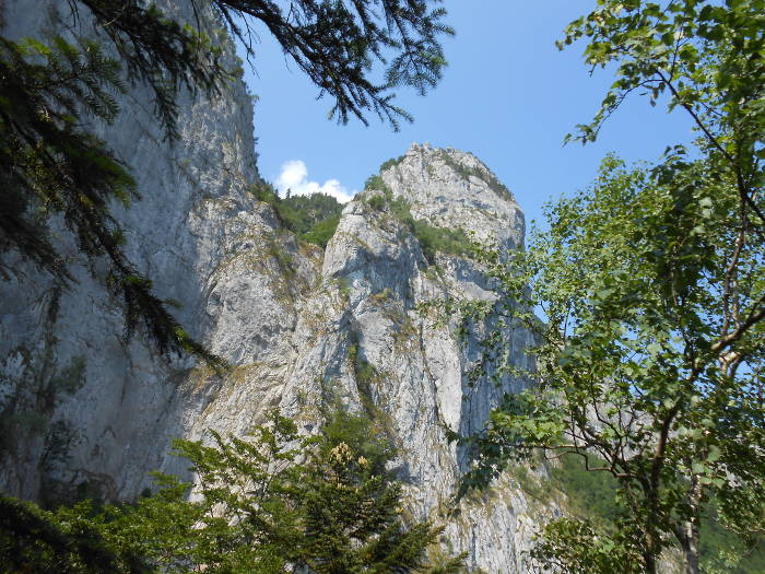
From here, the road follows the ridge line, revealing impressive views of the Capatanii Mountains when we are on the northern slope or the forested valleys that go up to Olt River or even to Cozia Mountain, when we are on the southern slope.
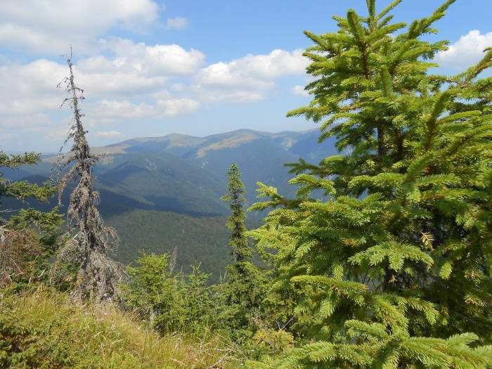
View from the ridge
I do not know how many “peaks” we have climbed or bypassed, but until we got under Vioreanu Peak we should mention a more “problematic” downhill
On the road
and a more spectacular passage across an area with giant stones and bottomless holes underneath. After this last passage, we intersected a blue-cross marked route with no indication regarding place where it goes.
We suppose it should be a retreat route for bad weather, but if he does not write anything, he has no utility. When we returned home studying the ones written by other travelers, we found out that it really would lead to the Peak Pine Shelter (Piscul cu Brazi). But I repeat, a landmark at its intersection with the ridge marking would be very useful.
So, let’s continue our journey!
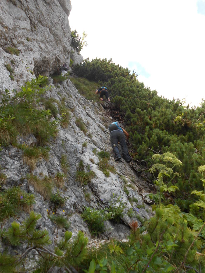
The things became more complicate from this point of the travel, especially because of the fatigue that begun to say its word. To climb Vioreanu Peak, we left a spectacular gully on the right and follow the red stripe marking on a very beautiful edge. We used the junipers to help us to go uphill on a dangerous area.
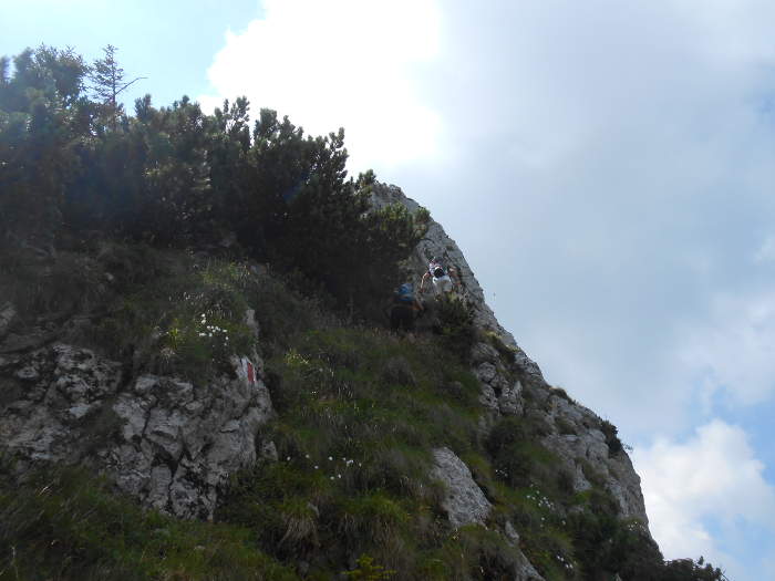
Difficult passage
After a road between junipers and flowers and then another quite athletic passage on an exposed wall, we finally got on Vioreanu Peak.
Climbing to Vioreanu
We saw surprised that on a rock was written “ Varful Vanturarita”.
On Vioreanu Peak
Things were clear when Max called “Wikipedia” told us that it was actually the Vanturarita Peak but after the establishment of the park for some reason it was considered that the highest peak should give the name of the massif. Thus the peak where we are now received the name Vioreanu and Vânturariţa was attributed to the highest peak that was to come on our way (the names of the two peaks have reversed).
So, to arrive on Vânturariţa (the current one), we had to get over two more peaks.
View from Vioreanu to Vanturarita
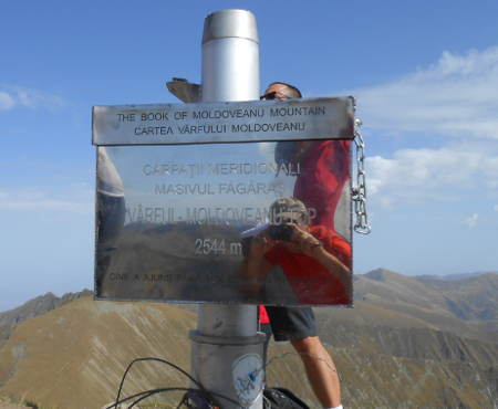
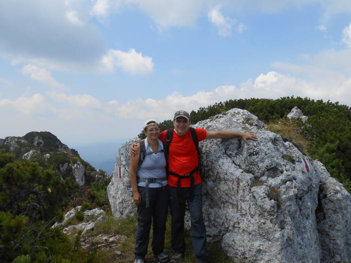
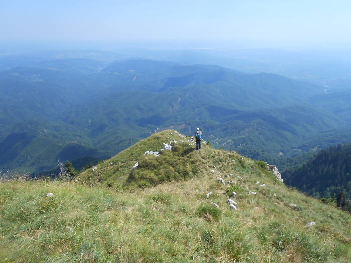
The beauty of the landscape is breathtaking (I forgot to tell you that it was a wonderful day) and so from a valley to another, most of the going time under the juniper, admiring the flowers, we reach Vânturariţa at 13.20 after 4.5 hours of walking.
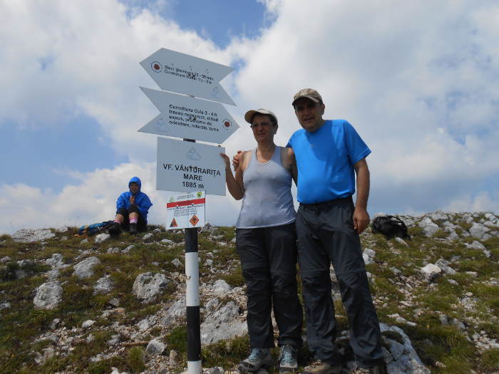
Finally on Vanturarita Peak
Here we met the first tourists. We have rested, admiring the landscape, and regretting that after so much climb we had to go downhill.
We began to descend to Ştevioara and from here through meadows and forests to Stâna (Sheepfold) Ştevioara where again an unseen dog announce anyone who wants to know that we are there.
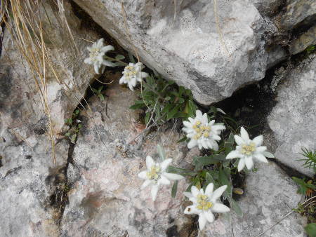
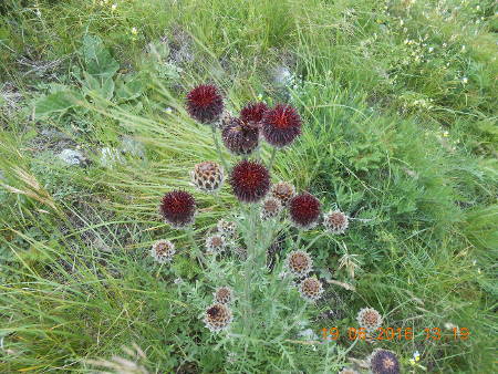
I forgot to tell you that depending on the area where we were at different times we found strawberries, raspberries, blueberries or blackberries.
The road from sheepfold to Pahomie Hermitage goes down only through the forest.
We arrived at 17 o’clock after 9 hours of walking.
Note that this route is waterless. A serious supply should be made at departure for all 9 hours.
It is known that this mountain has some pretty serious antecedents regarding electric discharges. I did not mentioned before, the sad moment when we passed the so-called “cross of thoese hit by lightning”, a place that reminds of the tragic event that took place here some years ago when four young people lost their lives. The weather forecast and the potential pathways of withdrawal should be studied if before the travel.
The yellow marking is a little bit poor up to Curmatura Oale, but in the ridge area, the red strip it is fresh.
Some places in the juniper areas, could be quite difficult to pass.
Return from Vanturarita
Day 2 route:
Starting point from the forest road to Cheia Chalet – Brâna Caprelor (The Goat’s Path) – Cheia Chalet and back on the forest road.
Marking: Blue triangle
After another night spent in the Cheia village, we went to the starting point for the second route. It is located on the forest road that leads to Cheia Chalet about 4 km from the branch to Pahomie.
We left the car in the road and followed the blue triangle. At the beginning it was a kind of country road that goes between raspberries and blackberries and then climbs hard through the forest. All the time we have giant walls in front of us.
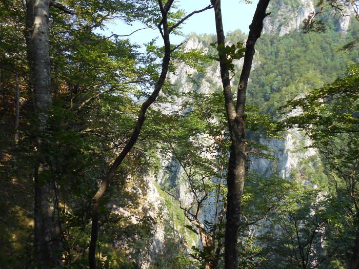
View to the walls of Cheia River Gorges
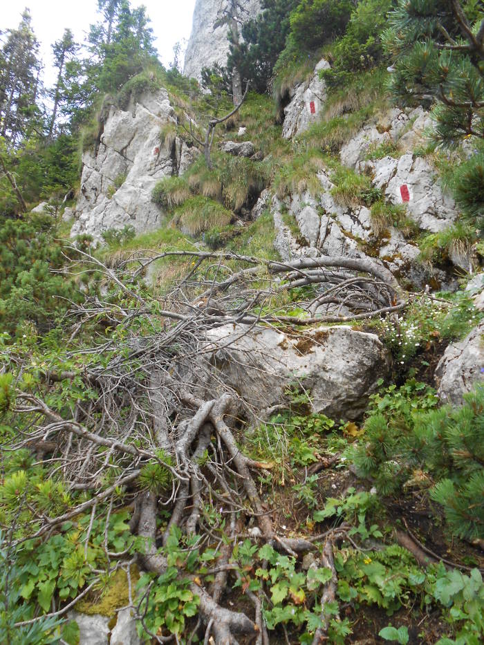
So, after crossing an area with scree, we’re in a saddle that has to the right a belvedere point with spectacular opening to Cheia River Gorges at … many tens of meters under our feet. But it’s still ok, the path is healthy, the scenery is superb. In the next few minutes the scenery remains gorgeous, but the trail is a bit of a problem because it sneaks down on a dizzying wall and descends into a very exposed passage where the only friends of the traveler are the strong roots of some stubborn trees that dare to grow up here.
Exposed Passage
We overpassed the most exposed section of the trail with many sighs and then follow the narrow path, about a 20-minute on level curve, until we reach another spectacular point of belvedere. We are resting preparing for a feet –breaking during the downhill on scree, under huge walls.
Limestone walls in Cheia River Gorges
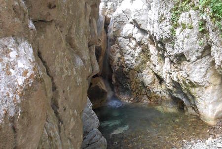
After another 20 minutes, we reach the point where amazingly, the water of the river disappears into the ground after resting it in a small lagoon, tired of falling into a wonderful waterfall.
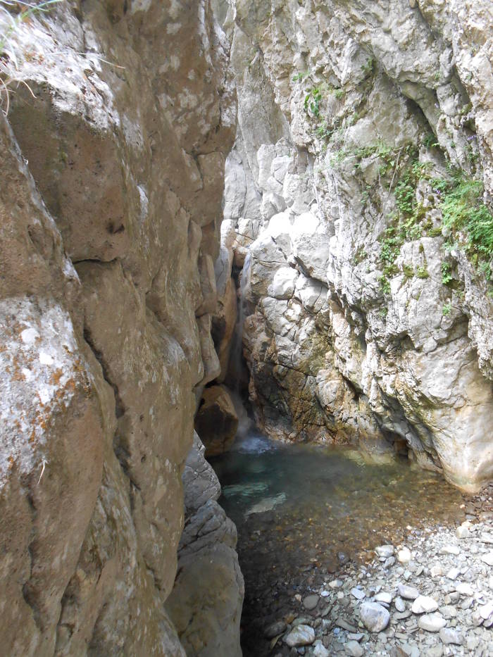
Cheia River Gorges
We rest, only to stay in this spectacular place, but remember what I said before: surprise … thunders. So we’re hurrying to get to Cheia Chalet as quickly as possible, even if it’s proving to be a false alarm. The road to the cottage follows the river bank and is very beautiful. We got to the cottage 2,5 hours after we start our trip. We make a short stop to see the place and pay the park fee and then we take it down the forest road through raspberries.
First, the road really goes uphill to the Curmătura Stogşoare where a tunnel crosses the mountain and only then begins to go down. I said forest road, you know what that’s all about. After about 4 km already the legs (more precisely the feet) go on strike and we have in front of another 6 km and a rain. We were lucky with some big-hearted tourists who took us by car for the rest of 6 km and so we got rid of the rain and ended well this wonderful weekend.
On this route the marking is very good. The route is very spectacular, the trail is good but it also has very exposed areas without any arrangement (cables, steps, etc.). As a conclusion, pay attention again to the weather forecast.
More Ideal Escapes